Operations
Aerial information.
Built for your decision.
AeroVis offers aerial mapping, thermal data collection and situational support across industries, along with counter UAS detection and monitoring. Start with what your team needs to understand.
We scope the complete deliverable with you, bringing in specialist partners where reporting or interpretation calls for their expertise.
Aerial mapping & visual documentation
A shared view of the site.
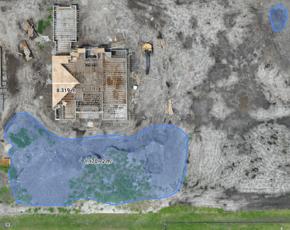
RGB imagery and orthomosaics give your team a visual record of a property or work area. Use them to document construction progress, compare visible environmental changes or give stakeholders a common reference.
We agree on the capture area, repeat visits and delivery format around the question you need to answer. For potential insurance collaboration, we can discuss the imagery and documentation a proposed workflow would require.
Example orthomosaic from the AeroVis website. Existing overlays are part of the source image, not a verified measurement deliverable for your project.
Thermal collection & reporting
From thermal imagery to a useful report.
Bring us the inspection question. We plan the thermal capture and reporting scope around the property, operating conditions and information your team needs.
AeroVis collects aerial thermal data and creates a thermography report. Capture requirements and reporting responsibilities are agreed as part of the deliverable.
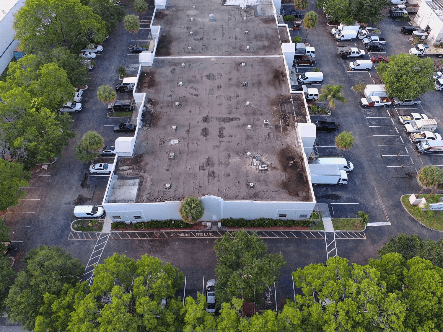
Example RGB roof imagery for visual context.
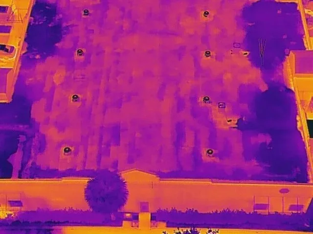
Example thermal imagery. Patterns guide further investigation; they do not establish a cause on their own.
Aerial situational support
A view for planning.
Awareness as work unfolds.
Give your team an aerial perspective for premission planning and real time situational awareness. For security and protective teams, that can mean reviewing site layout and surrounding conditions before a planned activity or discussing aerial information needs while work is underway.
We define the area of interest, timing and how the information will reach the people using it, with flight feasibility and permissions addressed in the scope.
Counter UAS
Detection and monitoring.
AeroVis offers counter UAS equipment sales, detection and monitoring, scoped to your organization’s needs.
Talk with us about what you need to detect or monitor and the information your team needs to receive. Equipment selection follows the Procurement route; detection and monitoring support is scoped through Operations.
Discuss detection needs → Ask about CUAS equipment → Explore products →
Understanding the output
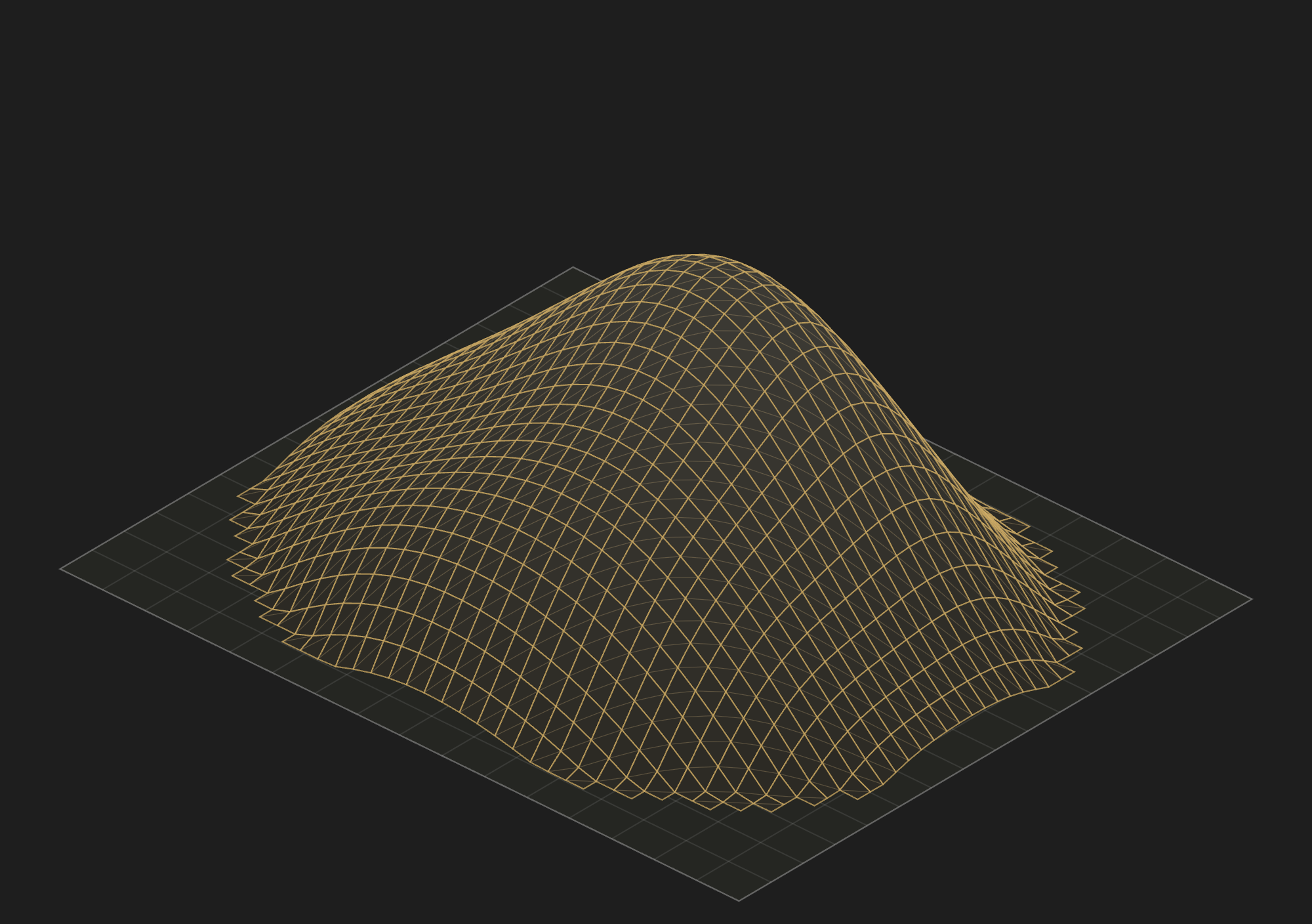
A surface model concept.
This illustration shows a terrain surface above a reference plane. It is a visual explanation only, not a current volumetric service offer or a measured project result.
The complete deliverable
Plan the handoff before the capture.
Tell us who will use the information and what they need to decide. AeroVis coordinates the collection and agreed deliverables, with partner responsibilities defined before the work begins.
Scope your deliverable → Meet our partners →
The decision
Identify the question and who will use the imagery, monitoring information or report.
The collection
Agree on site access, operating constraints and timing, including any repeat capture needs.
The delivery
Define file formats, reporting responsibilities and any accuracy or validation requirements.
Conceptual illustration. Original geometry, not a real capture or measured result.
Example photography and orthomosaic are retained from the public AeroVis website. They illustrate image types, not completed client engagements or current projects.