Aviation Discipline.
Applied to the Ground
We believe critical work deserves better than guesswork.
AeroVis delivers the aerial data teams need to make confident decisions across Broward, Miami-Dade, and Palm Beach counties, captured by a fully insured veteran-led operation built on twenty years of aviation experience
UAS LEVEL 1 THERMOGRAPHY CERTIFIED | FAA PART 107 CERTIFIED | 20+ YEARS AVIATION EXPERIENCE
UAS LEVEL 1 THERMOGRAPHY CERTIFIED | FAA PART 107 CERTIFIED | 20+ YEARS AVIATION EXPERIENCE
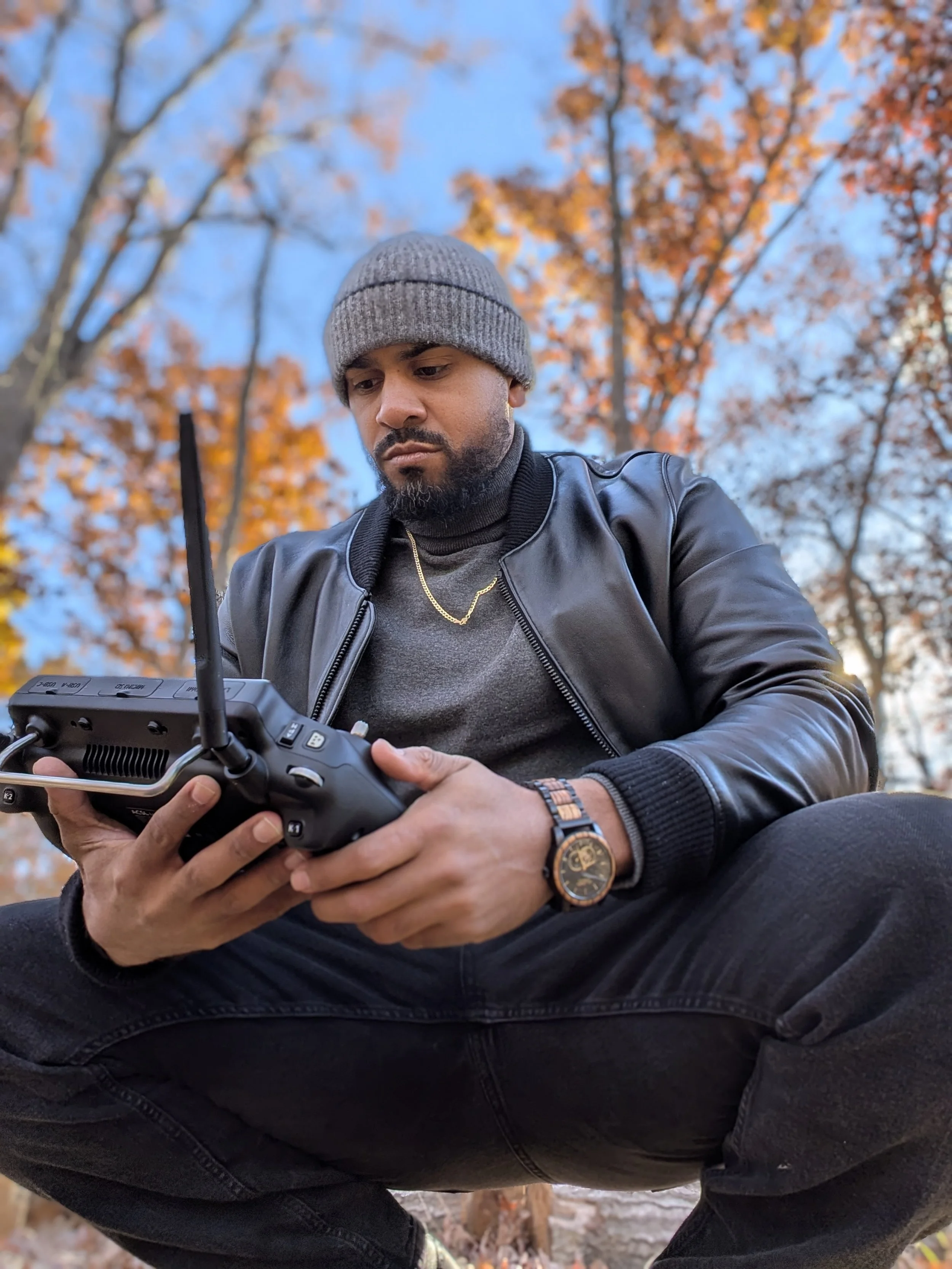
HOW WE FLY.
Job sites do not have time for guesswork. AeroVis flies every mission the way aviation runs every flight: with a written plan, a pre-flight brief, and a clear deliverable timeline. That means we show up ready, we work around your site without slowing it down, and we hand back data your team can use rapidly!
For projects across Broward, Miami-Dade, and Palm Beach counties, AeroVis scopes every flight around site access, airspace, operational risk, and deliverable timing.
Twenty years in manned aviation taught us how to operate safely around people, equipment, and tight schedules. We apply that same standard to every drone flight, from the first site walk to the final deliverable. No reflights. No surprises. No drama on your project.
The result is simple: cleaner data on the first flight, fewer change orders, and a vendor who makes your job easier instead of harder. That is what aviation-grade looks like applied to your project.
what you get.
Photogrammetry is one capability. The deliverables change based on what your team needs. Below are real examples from AeroVis projects, scoped to each client's mission.
FOR ROOFING, ENERGY, AND INSURANCE INSPECTIONS
FOR CONSTRUCTION AND EARTHWORK PROJECTS
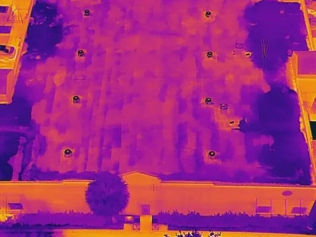
Thermal reveals heat loss and trapped moisture invisible to the naked eye.
The dark zones are where the inspection just got expensive, or where it prevented a six-figure repair.
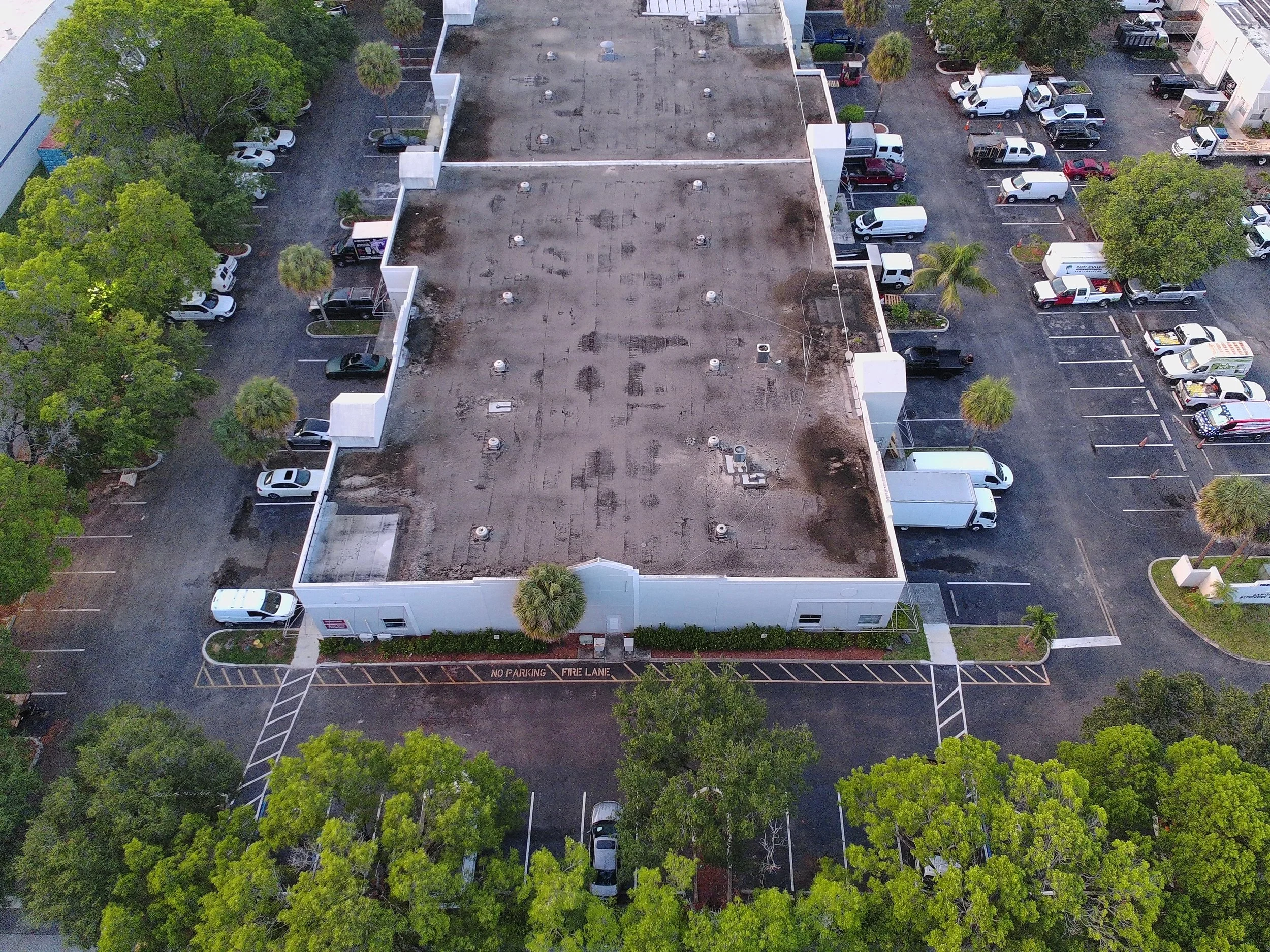
Standard inspection view. From the air, the roof looks clean and intact.
This is what a typical visual inspection would document and sign off on.
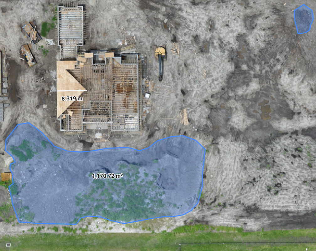
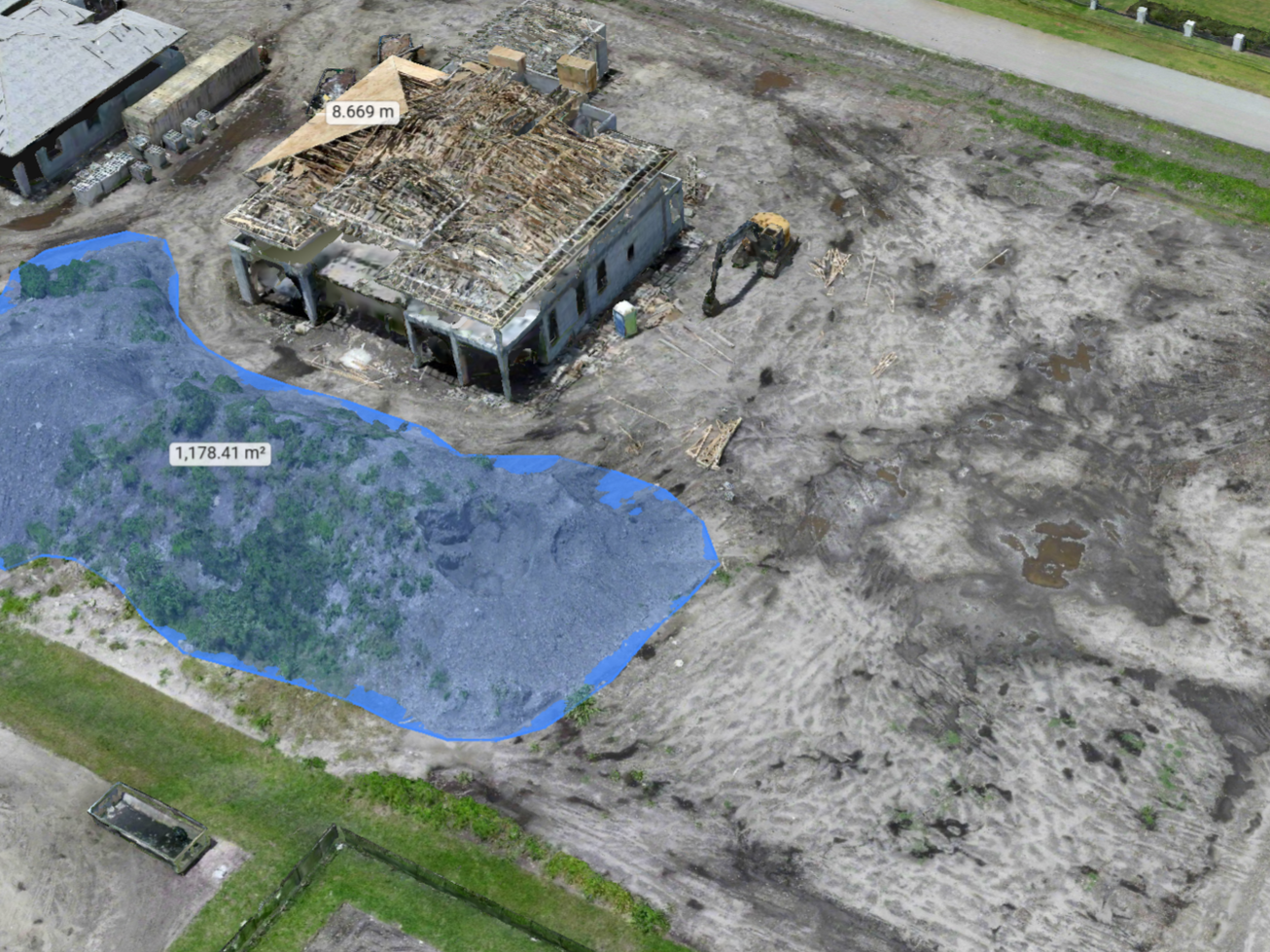
Top-down site view with measured distances and area calculations. Surveyor-grade data ready to drop into your existing workflow.
Cut, fill, and volume calculations from the same scan. Built for teams tracking dirt budgets and validating progress billings.
FOR SITE PLANNING, PROGRESS TRACKING, AND STAKEHOLDER REVIEW
Every AeroVis project lives in the cloud. Pan, zoom, measure, and share the same site model across your entire team from any device. Track changes between flights, mark up findings for subcontractors, and give owners and stakeholders direct access without sending anyone to the field.

ADDITIONAL CAPABILITIES
Beyond commercial photogrammetry, AeroVis supports executive protection teams and organizations protecting sensitive locations. These engagements are scoped directly with the client and are not advertised publicly.
-
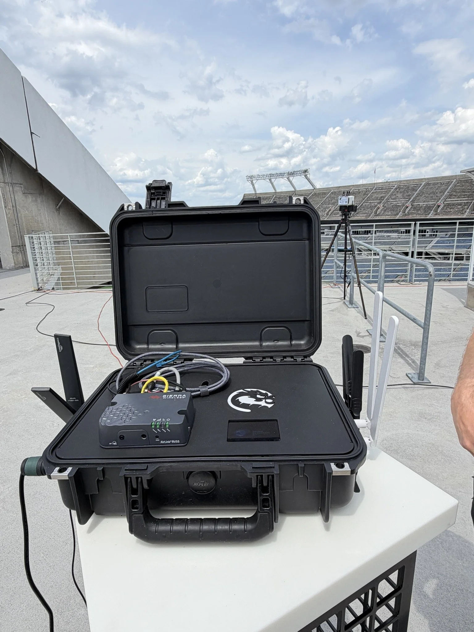
Pre-mission site intelligence, route and location mapping, and live aerial overwatch for protective ground teams. AeroVis operates as a civilian ISR asset for principals, events, and facilities requiring discreet aerial coverage. Available to qualified executive protection firms and private security clients.
-
Detection-focused Counter-UAS consulting for organizations facing unauthorized drone activity around sensitive locations. AeroVis provides assessment, recommendations, and integration guidance for protective teams seeking to understand and respond to UAS-related threats. Available to qualified government, infrastructure, and private security partners.