INSURANCE & DAMAGE ASSESSMENT
INSURANCE CLAIMS MOVE FASTER WITH EVIDENCE THAT DOESN’T LIE.
What Sets Us Apart
FAA-certified drone pilots with military aviation backgrounds – every damage assessment is documented to the same precision standard as flight operations, not a quick flyover
Property damage expertise across hail, wind, storm, and flooding events – we document damage patterns visible only from above with aerial thermal and RGB imagery
Same-day drone inspection reports delivered to your cloud portal – georeferenced, timestamped, and formatted for insurance adjusters, property owners, and legal teams
Complete property damage history per property – every drone flight builds on the last so you can track deterioration, document pre-existing conditions, and support claims with evidence that sticks
Preferred Provider Agreements available for insurance carriers, public adjusters, and restoration contractors – priority scheduling and volume pricing
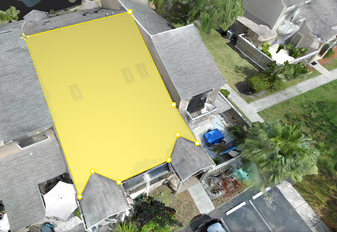
We deliver damage intelligence, not just aerial photos – every report includes GPS-tagged defect locations, annotated damage maps, and actionable documentation your team can present immediately
THE COST OF UNDOCUMENTED DAMAGE
Every unresolved insurance claim is a financial risk. Miss documenting damage after a storm event, lose track of what existed before a new claim, and the dispute bill multiplies. Most property owners and adjusters rely on ground-level photos and call it done. Few understand what it actually takes to document a property from a single-family home to a 200,000 sq ft commercial facility.
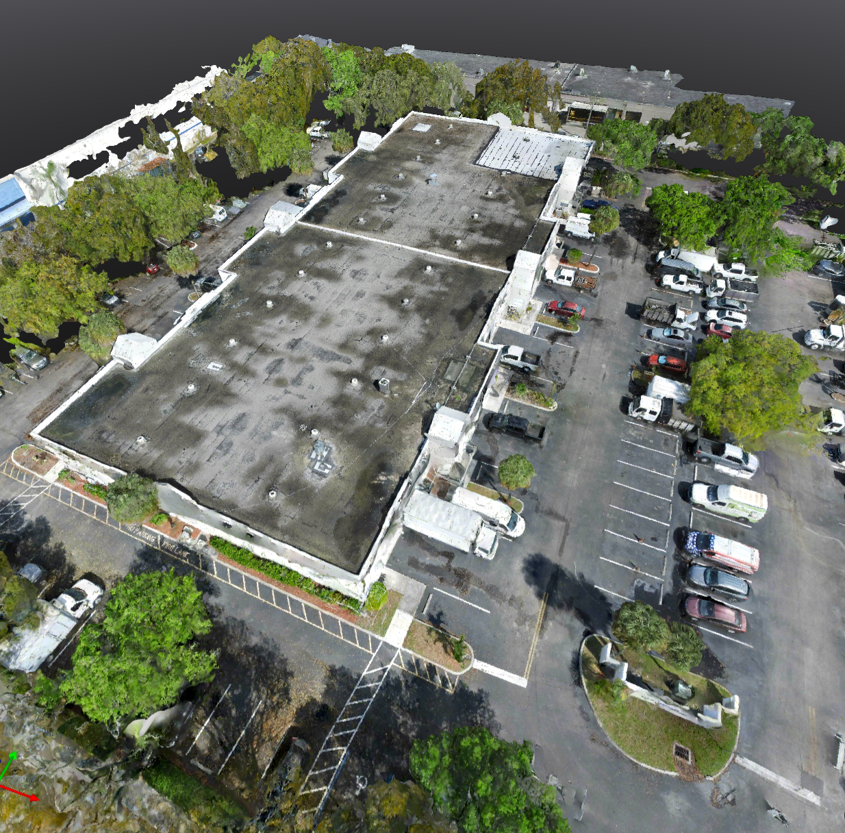
HOW THE DRONE ROOF INSPECTION WORKS
We start with a scope call to understand your property – the roof type, the condition, and the data your team actually needs. Then we fly, process, and deliver. Every deployment is planned to aviation standards and executed the same way every time, whether it’s your first inspection or your fiftieth.
YOUR ROOF INSPECTION DELIVERABLES
High-resolution thermal and visual imagery, annotated damage reports, and inspection documentation delivered to your cloud portal. Your complete roof history in one place – inspection by inspection, from pre-install to post-storm. Shareable with your whole team and insurance adjusters the same day it’s flown.
DRONE INSURANCE & DAMAGE ASSESSMENT SERVICES
AeroVis specializes in FAA-certified drone insurance documentation and property damage assessment for residential and commercial properties. Our services include: post-storm damage inspections for hail, wind, and flooding events; pre-claim property documentation for insurance adjusters and public adjusters; same-day aerial damage reports for insurance carriers and legal teams; thermal infrared inspections to detect moisture intrusion and hidden structural damage; and ongoing property monitoring for claims in progress. Every assessment is scoped to your specific property, damage type, and documentation requirements – not a one-size-fits-all flight plan.
DRONE DAMAGE ASSESSMENT FAQS
-
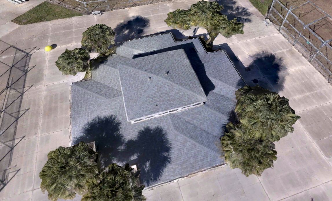
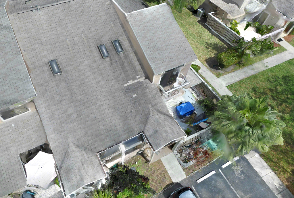
AeroVis drone damage assessments cover all property types — including single-family residential homes, multi-family properties, commercial office buildings, warehouses, industrial facilities, retail centers, and large commercial complexes. Our FAA-certified pilots use high-resolution thermal and visual cameras to document hail damage, wind damage, flooding, and storm-related structural damage on properties of any size.
-
Significantly more accurate and comprehensive. Drone aerial documentation captures high-resolution 4K imagery and thermal data showing damage patterns that ground-level photos completely miss — including roof damage scope, hidden moisture intrusion, structural displacement, and flood damage extent. Every image is GPS-tagged, timestamped, and delivered with annotated damage maps — documentation that holds up in insurance disputes and legal proceedings.
-
AeroVis drone damage assessment reports are built to meet the documentation standards used by insurance carriers, public adjusters, and legal teams. Our reports are georeferenced, timestamped, and formatted with annotated damage maps — giving adjusters and legal teams the evidence they need to act quickly on storm damage claims, hail impact assessments, flood documentation, and pre-claim property surveys. Property owners and roofing contractors can use our documentation to support claims resolution and reduce disputes.
-
Most residential property damage assessments take 30–60 minutes on-site. Large commercial properties up to 200,000 sq ft can be completed in 2–3 hours. AeroVis delivers your full assessment report — including annotated aerial imagery, GPS-tagged damage locations, and condition summary — to your cloud portal the same day as the flight. No waiting days or weeks for results your adjuster needs immediately.
-
All three — and more. AeroVis serves residential property owners needing post-storm documentation, public adjusters and insurance adjusters who require aerial evidence for claims, roofing contractors who need damage documentation for bids and warranty claims, commercial property managers overseeing storm damage across multiple sites, HOAs, and real estate investors conducting pre-purchase due diligence. Our Preferred Provider Agreements offer volume pricing and priority scheduling.
-
Yes. AeroVis provides drone damage assessment services for single-family homes, multi-family residential properties, apartment complexes, commercial office buildings, warehouses, industrial facilities, and large retail centers. Whether you need a single post-storm documentation flight or ongoing assessments across a portfolio of commercial properties, our team has the equipment, certifications, and aviation-standard procedures to deliver reliable, court-ready documentation every time.
Ready to Get Started?
Every inspection is scoped individually. Book a free 20-minute call and we’ll have a proposal back to you the same day.